Planned stations
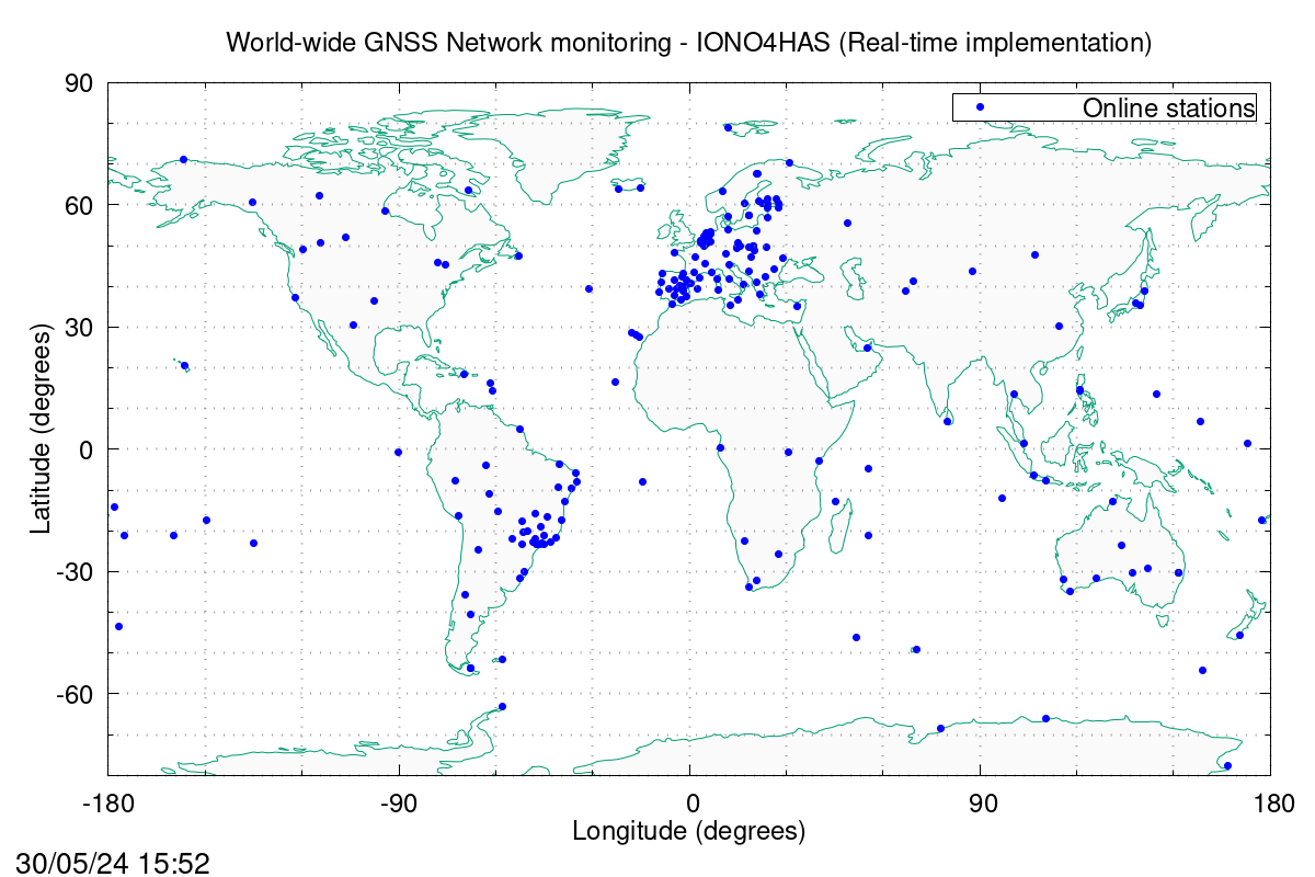
The complete network of GNSS stations involves the International GNSS Service (IGS) network, the European Permanent GNSS network EUREF, the Brazilian Network of continuos GNSS monitoring (Rede Brasileira de Monitoramento Contínuo dos Sistemas GNSS - RBMC), the Argentinian National Geographic Institute Network (Instituto Geográfico Nacional - IGN), the Equadorian Network of continous GNSS monitoring (Red GNSS de Monitoreo Continuo del Ecuador – REGME), the Australian Continuously Operating Reference Stations (AUSCORS), and the North-american UNAVCO.
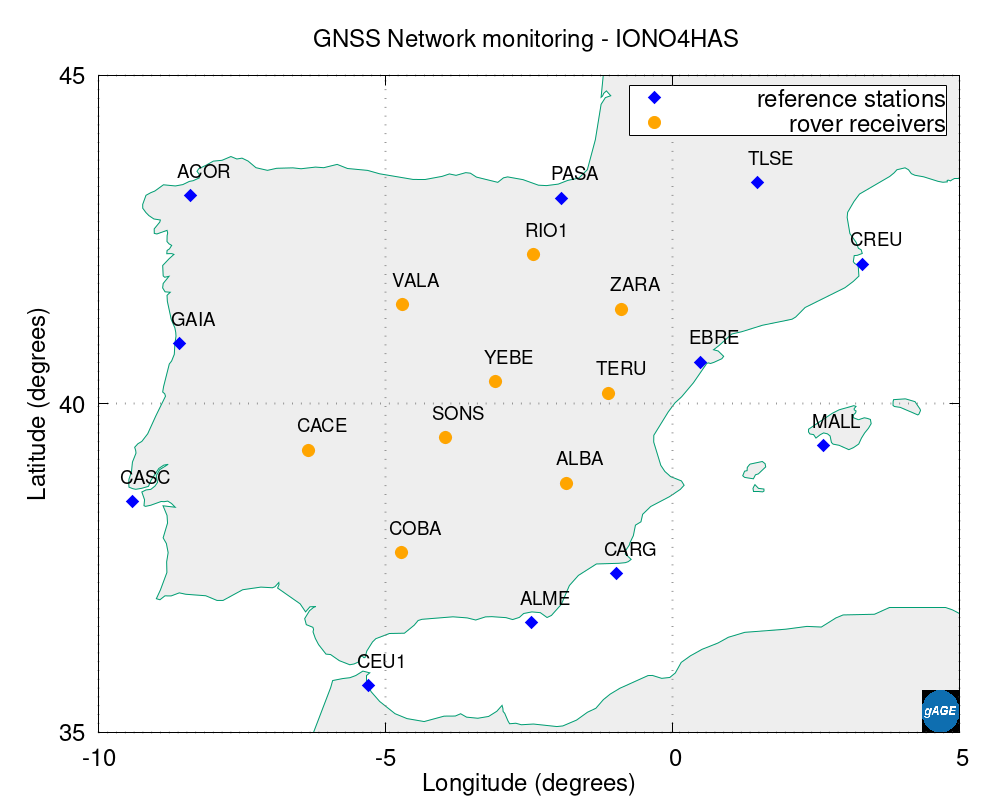
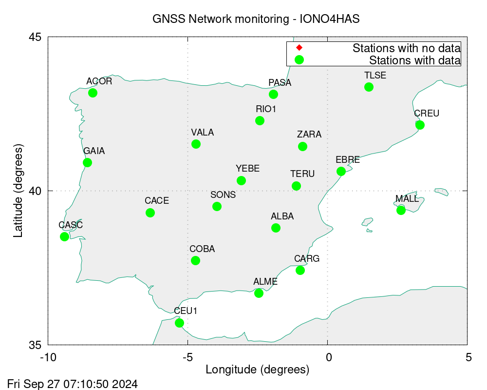
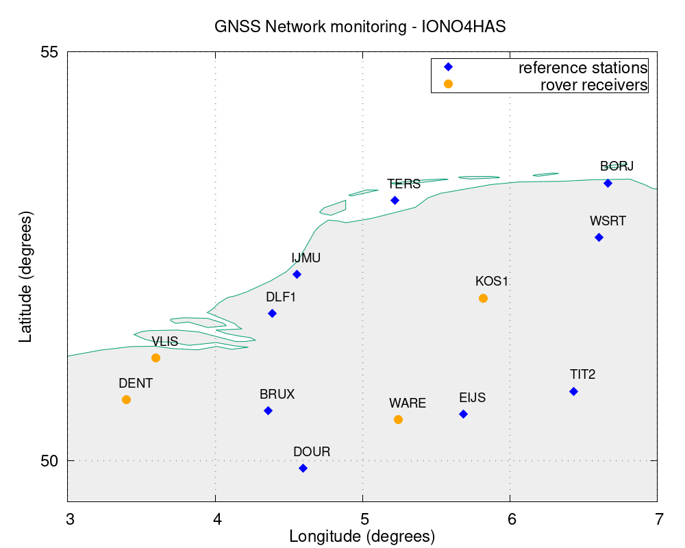
Depicted in the next plot, the location of the GNSS stations implemented in the IONO4HAS computations: Blue squares indicates stations used as reference (permanent) receivers, while light-green indicates stations implemented as rover (user) receivers.


click in the arrows to move between plots. Click on plot to enlarge.
❮ ❯
Thanks to the current architecture of GNSS stations, it is possible to design dedicated sub-networks at specific regions with different characteristics, aiming to assess the performance of the IONO4HAS tool in real-time. We present different sub-networks:
Spanish sub-network
9 rover receivers located at the interior of the Iberian Península surrounded by permanent receivers boarding the continental perimetre.
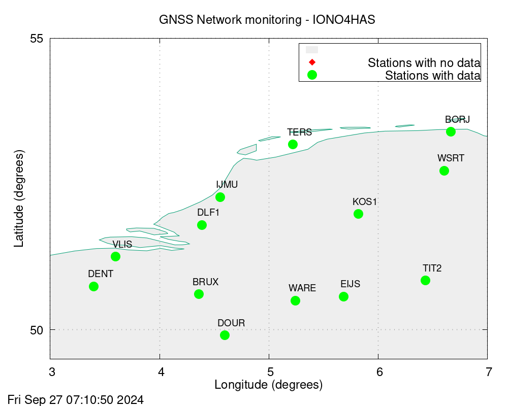
West-central Europe sub-network
4 rover receivers located at mid-high latitude with GNSS stations from Belguim, Germany and the Netherlands. The IONO4HAS modelling reference station BRUX is processed here.
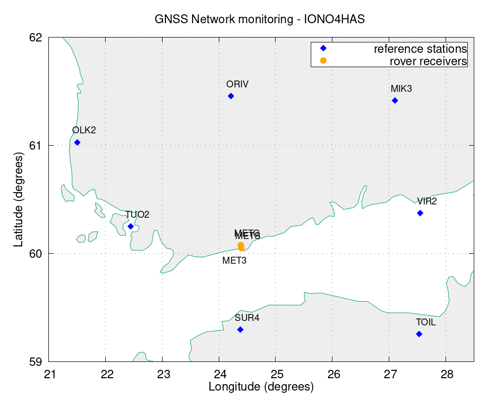
Finnish sub-network
Located at high latitude, this sub-network offers the possibility to assess the effect of using multi-constellation observations at the user level, thanks to its two rover receivers: MET3 and METG, configured to operate with only GPS signals (MET3) and GPS+GALILEO signals (METG).
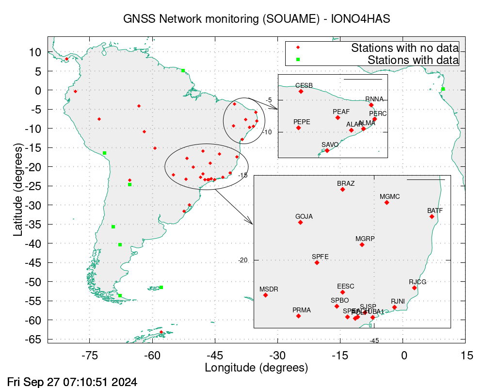
Brazilian sub-network
This sub-network recreates challenging scenarios whith long distances (with respect to the other sub-networks) between rover receivers and reference receivers, located at the mid-latitude in South-America.

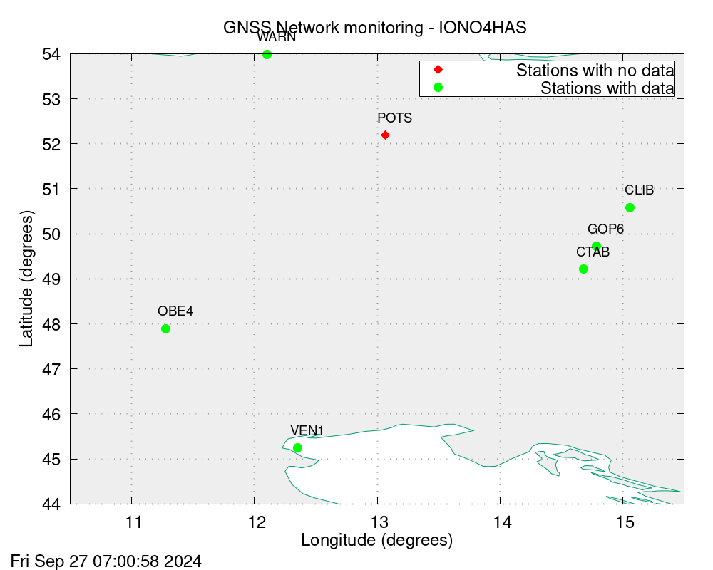
Eastern Europe sub-network
With one single rover receiver, this sub-network allows to monitor the effect on the ionospheric model of having reference receivers located at the west side of the rover receiver and one single reference receiver at its east side.

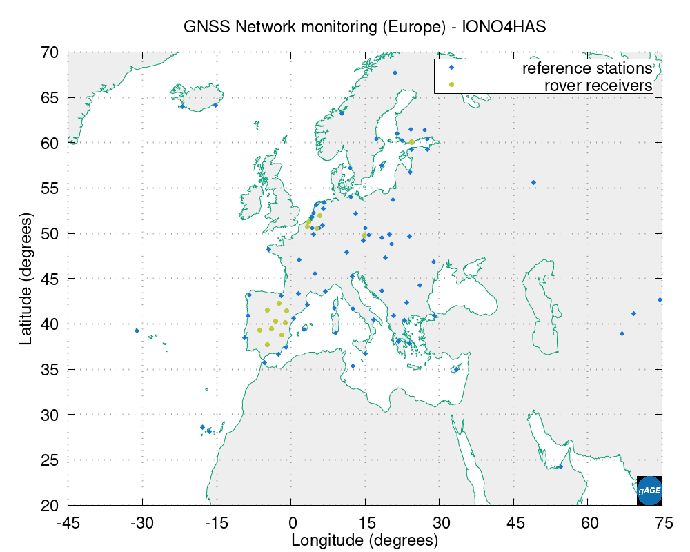
European Network
The european cluster of GNSS stations.
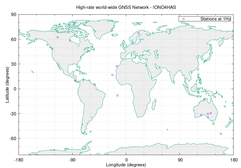
High Frequency receivers Network
This network provides GNSS streams with data at 1Hz.
GNSS data streams monitoring
The following table contains, for each station in use, the GNSS streams data flow in the IONO4HAS tool. RINEX (blue) are collected from different receivers to form the so-called prefit residuals
(in yellow). Then, the next plot presents the convertion of the prefits (now in blue) into the unambiguos STEC data (yellow).
Choose one station from the next two images selectors and check the data flow: